
Forestree
Remote sensing and Forestry


Tree really matters
Contribution to our society and ESG directions
Development timeline
Data analysation with CSDI
Our team
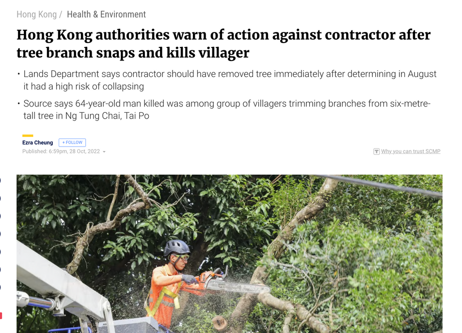
Tree crashes onto school bus and cars, Perth Street
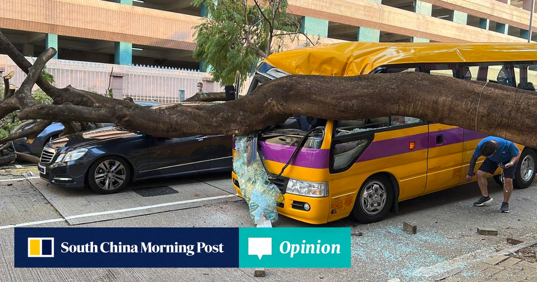
Tree crashes onto a car, Haiphong Road
Natural growth cycle of Trees
Trees go through a natural cycle of growth, aging, and death, and many of the trees planted in Hong Kong during the 1950s and 60s are now reaching the end of their lifespan. As such, it is important to reforest with native tree species that are better suited to current environmental conditions.
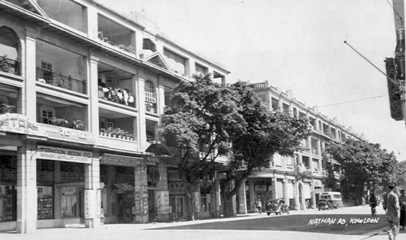
1950s Nathan Road | History pictures, Hong kong, Banyan tree
Senescence and Death
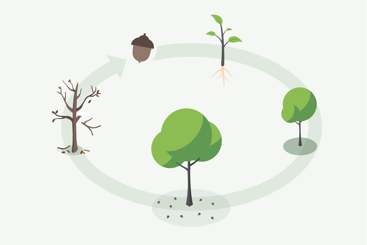
Seed Germination
Tree's natural cycle of growth
Adult Growth
Seedling Growth
Juvenile Growth
Forestree
Remote sensing and Forestry
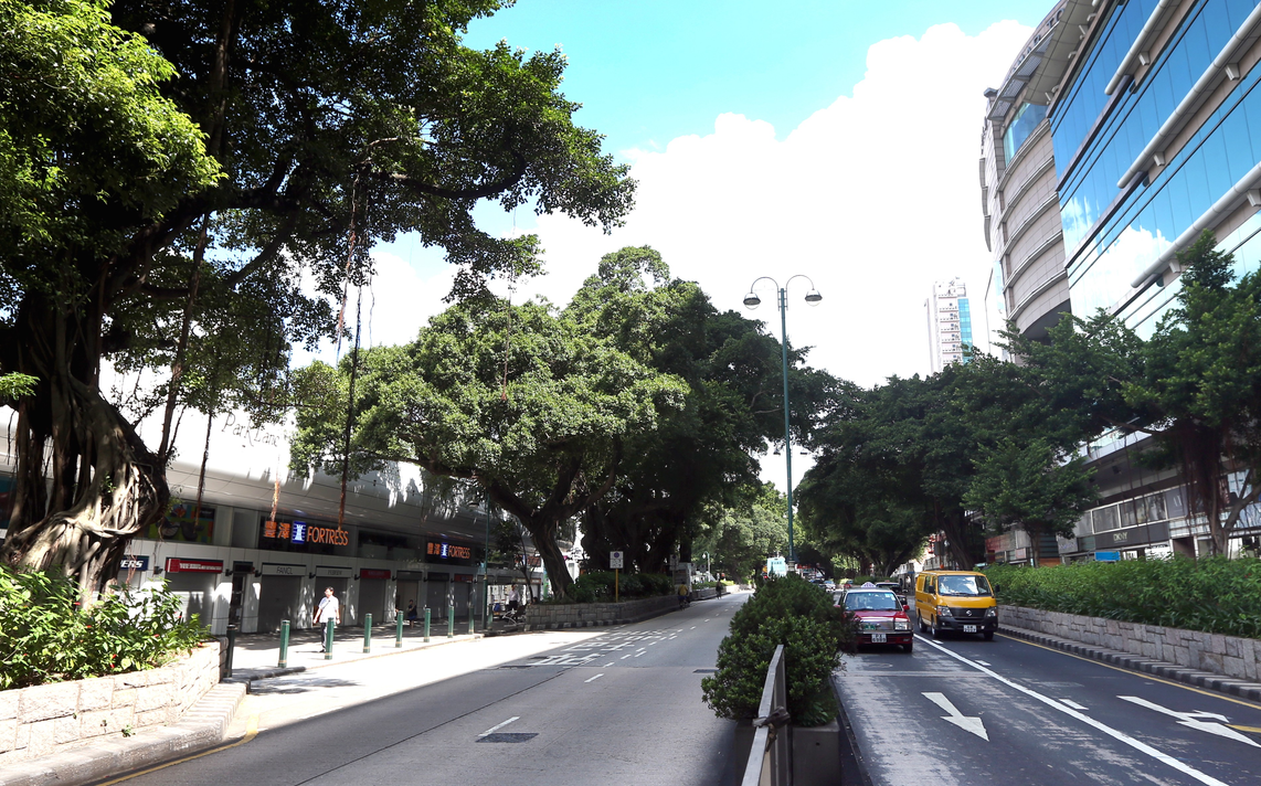
Vegetation and Urban
Concrete jungle Hong Kong to get diverse array of plants on urban streets in drive to green the city
Trees provide a valuable contribution to the environment by helping to reduce the impact of urban heat islands, improving air quality, and providing shade and shelter to the public.
They can also help to support the goals of carbon neutrality and sustainable development, with the real estate sector increasingly using trees to create low-carbon gardens and green buildings.
The first zero carbon building in Hong Kong
Forestree
Remote sensing and Forestry
Why Tree really matters?
Trees can shade from rain and even have the function of insulating heat and noise.
Trees in Hong Kong's subtropical zone are vulnerable to typhoons and wet weather
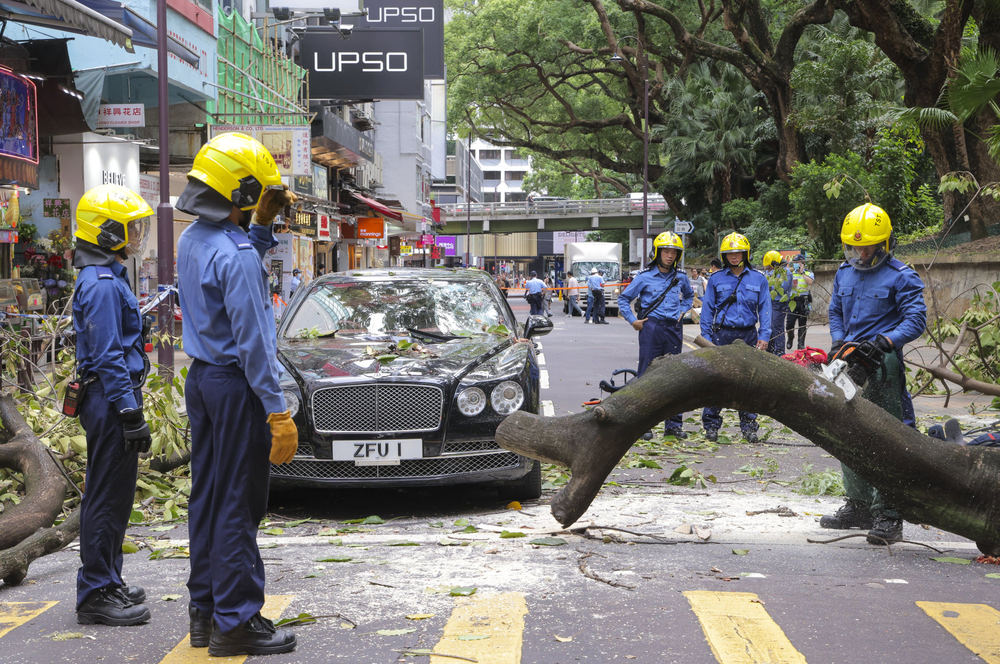
Tree health can directly affect people's safety
In October of last year, there was an incident in which a single tree smashed people to death.


Toward the smart city development, why and how to manage our forest and trees?
Forestree
Remote sensing and Forestry
The way to manage trees
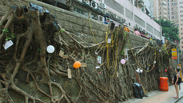
In recent months, there have been reports of stone walls and slope trees falling down one after another. The issue is compounded by the fact that the tree management department lack of united cooperation with other departments.
Forestree
Remote sensing and Forestry
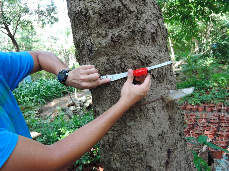
Traditional tree inventory methods are limited, and it is difficult to keep track of a territory wide tree statistics.
Therefore, it is essential to develop large-scale local tree management using remote sensing techniques. This will enable authorities to identify vulnerable trees, monitor their health, and take proactive measures to prevent tree-related accidents.
Forestree developed an
Automated solution to manage trees in terrioriy-wide scale
Different types of forest in Hong Kong
Fung Shui Wood
Native woodland, usually a region of vegetation near a village.
Woodland and Shrublands
Tree covered areas which arose naturally
Secondary forest
regenerated through natural processes after human-caused disturbances
Plantation forest
established by planting and seeding, unnaturally
Forestree
Remote sensing and Forestry
Common ESG measures for smart city forestry
Evaluating by its age and species
assess the development area tree's age and species
Rearranging by plantation
logging first, forest plantation afterwards
Preserving
keeps the original wildlife habitat, such as Lok Ma Chau Wetland
Forestree
Remote sensing and Forestry
Vertical green wall
build and create a green wall and tree plantation
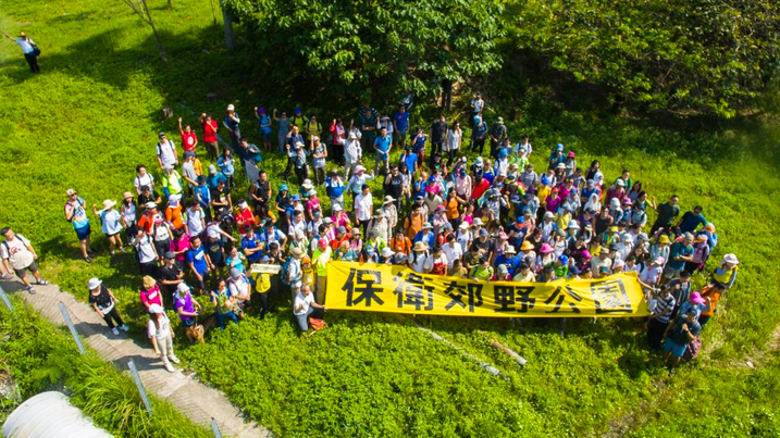
Development verse Preserving trees ?
Housing preseures leading to develop the secondary woodland
Developers are keen on developing the peripheries parts of the current country park, the government was forced to develop public housing to fulfill the needs and solve the inequalities.
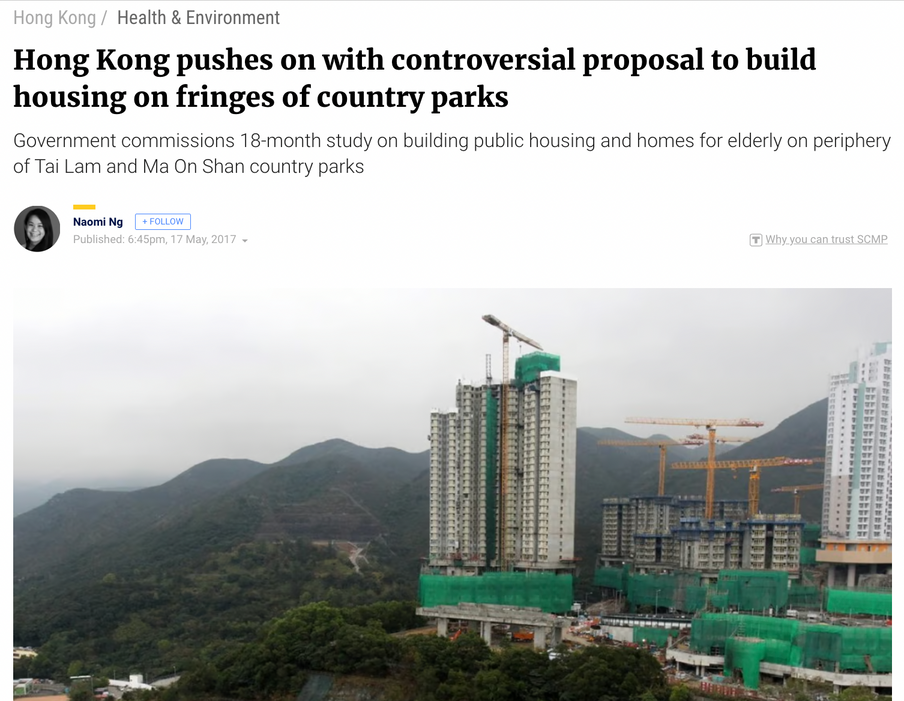
Striking a balance between development and preserving the environment
A critical challenge for Hong Kong's next three decades of urban planning
Fung Shui land and Lowland Forest are the easiest part to be developed for housing, at the same time, the developers and NGOs are looking at the forest plantations that trying to reduce the impact on the environment.
Forestree
Remote sensing and Forestry
Challanges to strike a balance and preserve our forest
Limited availability
Constant pressure to develop housing and infrastructure, that leads the conversion of forested areas into land for development
Development needs and interest
Fanling Golf Club is a typical sample that shows the conflict between development and preserving the woodlands.
Histroical factors
Due to the complex land ownership in NT, such as the the permitted burial ground and government compensation issue for the woodland and development site selection.
Hillfires
Damage to develop, common method in NT landowner can deforestated their farmland, lower the ecological value to get a higher compentation.
Forestree
Remote sensing and Forestry
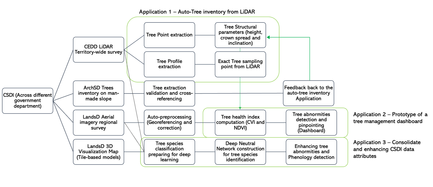
How Forestree toward ESG win-win situation with CSDI Open data

Automatically Tree inventory application
Developers and policy makers can make use of our application to generate a quantitative tree invertory report for their final decision.
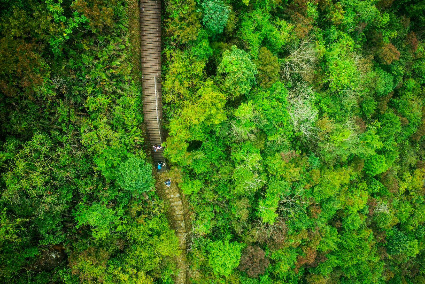
Data collected by CEDD LiDAR point cloud and colorised by LandsD aerial image
Forestree
Remote sensing and Forestry
Deciding and Optimisation
If the lands development need to deforestated/ cut off some of the vegtatation covers, optimisation and minimised the logging area can be with Forestree.


Monitoring and management
From aerail imageries, we are avaliable to retrive the tree health conditions and manage with remote sensing techniques to keep our forest safe.

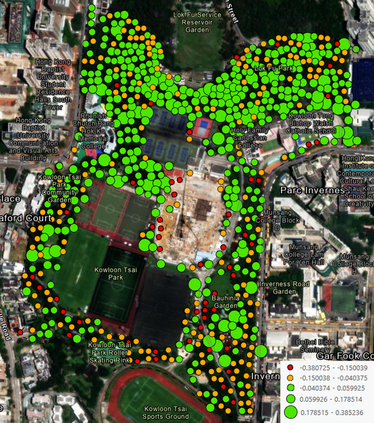
Data analysation with CSDI and Our Systematic workflow


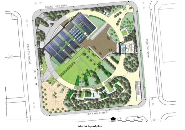
Output of the Fung Shui Woodland
Forestree
Remote sensing and Forestry
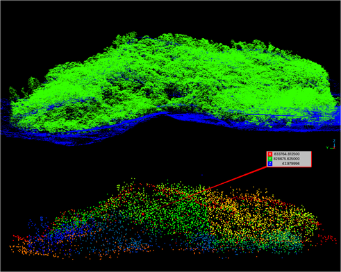
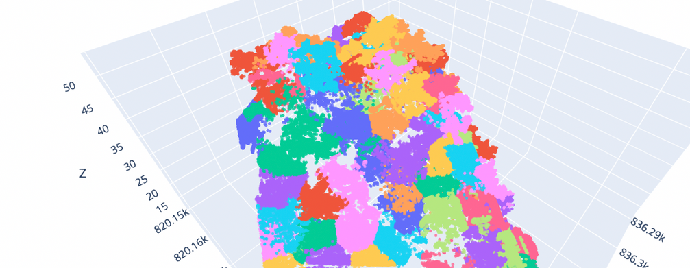
Our Auto-extraction application
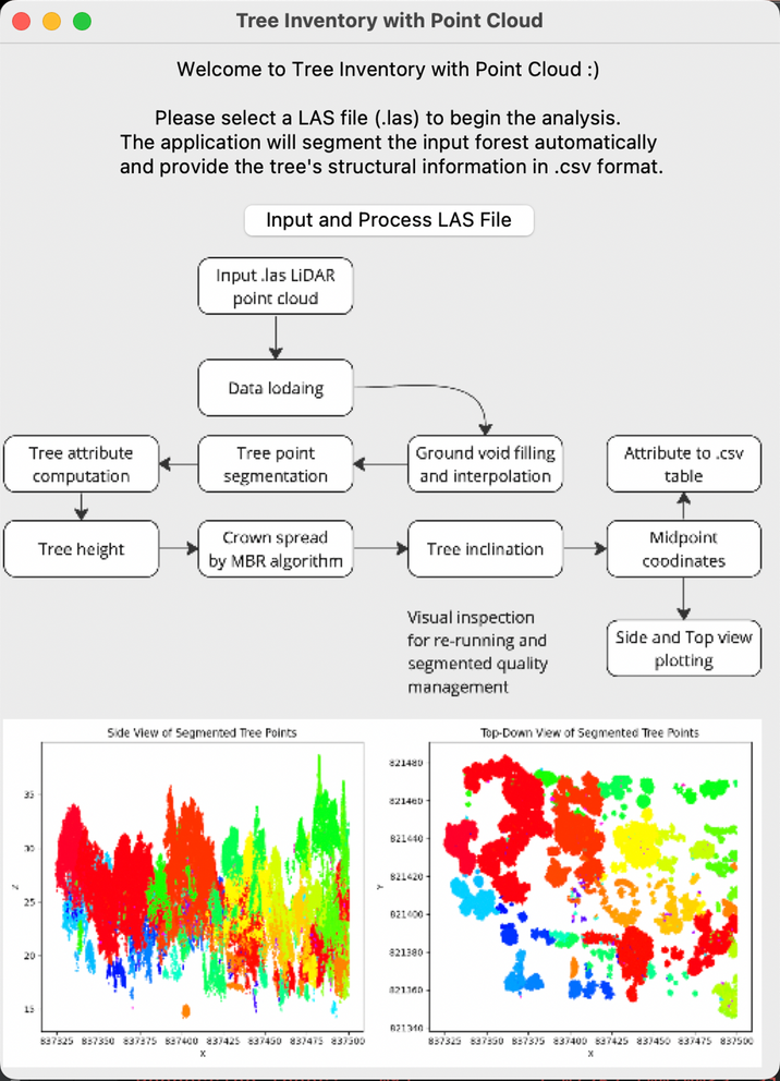

Our Processing Status bar
Tree Invertory with Point Cloud GUI
Forestree
Remote sensing and Forestry
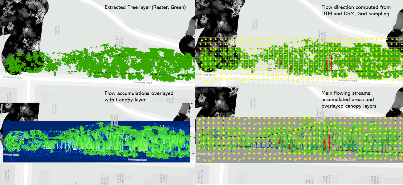
Post-procssing 1 Canopy-Slope intergated Simulation
Simulate and inspection across trees in man-made slope
Most of the tree collapse cases is caused by the tree root damage.
Roots may decays with infilterated water, so post-procssing the DSM, DTM into slope, flow directions and accumulation may filter in the potential root damage areas with GIS techniques.
Post-procssing 2 Health monitoring and prediction
Tree health map
LandsD has been continuously capturing aerial imagery of trees, which can be used to compute various vegetation indices such as the Normalized Difference Vegetation Index (NDVI), Enhanced Vegetation Index (EVI), and Green Chlorophyll Index (GCI). These indices can be used to evaluate changes in the canopy and tree growth over time.
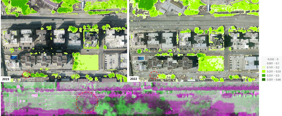
Base on the reflection and plant nature itself, the dead leaf has very low chlorophyll, anthocyanin content and reduced photosynthetic activity, stressed leaf compare has a relative higher content than the deadwood, the healthy leaf has the highest reflectance to the sensing platforms.
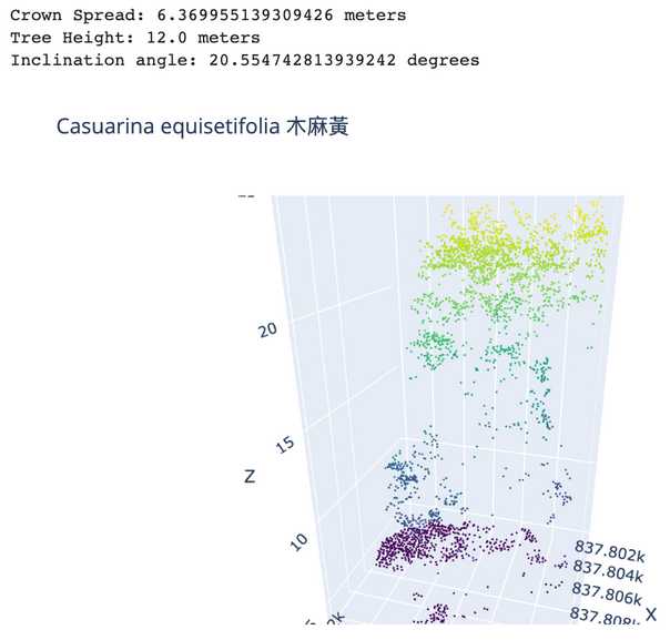
Post-procssing 3 Deep learning with Local Tree species
Tree can be study and identifies with Deep learning
Such as the Multi-trucks (Co-dominated), by the intensity value we can derive the multi-trucks from it, Delonix regia
Moreover, the tree leafs structures like Casurina equisetifiolia (needle like) leafs can identifies by the point density
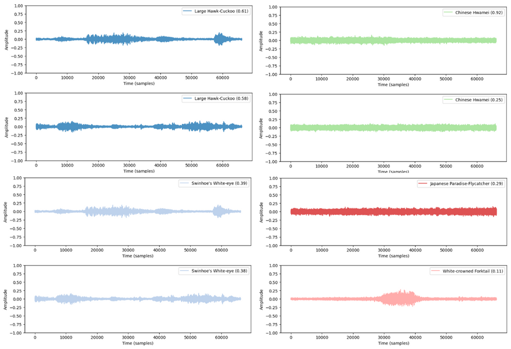
Integrated-processing Soundscape Ecology for EIA
Tree-Bird Automatic Classification and invertory builder
Forestree now intergate with the soundscpae to automatically classifies bird species across the terriories, this process coorperate with AK IN KK bring the 1D sound wave georeference and correalted with the 3D forest space.
This builder foster the process of the EIA data acquisition and field observation process.

The Honourable sound recordings Artist
AK IN KK - Nature Field Recording HK
Mr. Kan Hei Chun (Field recordist)
Development timeline and sustabiable plan


Sustaibale plan :
Consolidate the auto-tree inventory
Transform into .exe based application
Deep neural network development for tree species classification
Monthly update in the Tree Management Dashboard
Forestree
Remote sensing and Forestry
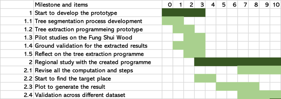
Our important dates and keep milestones:

APR
01

MAY
01

JUN
01

JUL
01
Prototype
Study and revise the idea
Development
Application programming, trail and error testing for auto tree inventory
Deep leanring
Future development in tree species identifcation
Application Revise
Revise, improve and enhance the Forestree idea toward the social needs
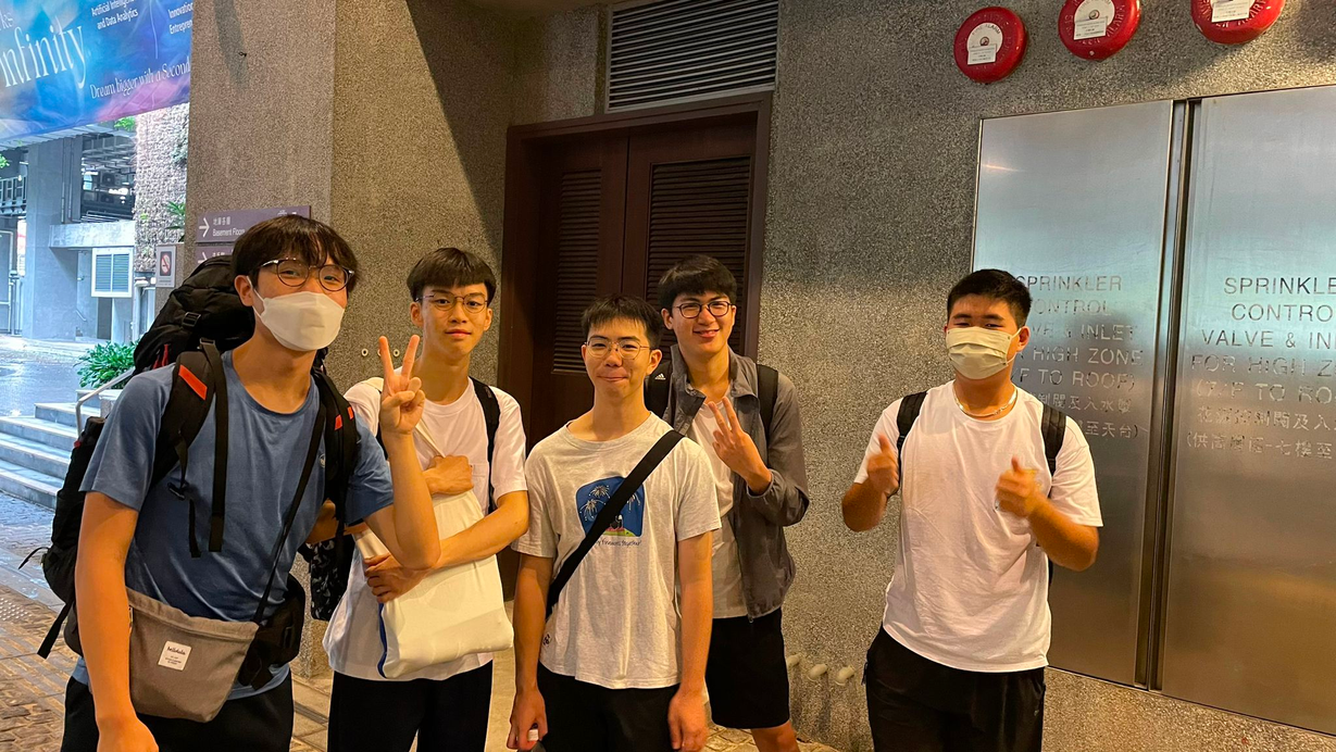
Team of Forestree
Ho Chun Kai, Data Scientist
Lam Yik, Data Scientist
Lau Sze Chun, Geospatial-Analyst
Lo Sze Chai, Geospatial-Analyst
Yu Kai Him Otto, Project Coordinator
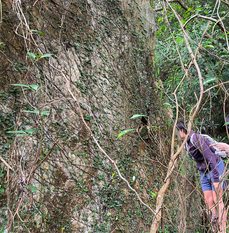
Some of the on ground validation trip:
Group of student from Land surveying and Geo-informatics, PolyU
Keen on GIScience, Remote sensing, Photogrammetry and Forestry.
Yu Kai Him Otto
Lam Yik
Lo Sze Chai
Lau Sze Chun
Ho Chun Kai
For Forestree project and application details, please contact kai-him-otto.yu@connect.polyu.hk (Otto Yu).
Forestree
Remote sensing and Forestry
Reference and acknowledgement
We are grateful to express our appreciation to our mentor Ms. Kimmy Ng from HKSTP, Dr. Yan Wai Yeung and Dr. Sissi Chen from PolyU, for their advice, support and guidance throughout the CSDI Award 2023.
Agnew, M. (2018). Hong Kong housing crisis: government will develop country parks unless we stop them as task force is for show, says Greenpeace. South China Morning Post, Web site: https://www.scmp.com/sport/outdoor/trail-running/article/2155169/hong-kong-government-will-develop-country-parks-unless
Ahamed, T. (2022). Remote Sensing Application : Regional Perspectives in Agriculture and Forestry (T. Ahamed, Ed.; 1st ed. 2022.). Springer Nature Singapore. https://doi.org/10.1007/978-981-19-0213-0
Bryan C. Pijanowski, Almo Farina, Stuart H. Gage, Bernie Krause, Nadia B. M. Oliveira, Soundscape Ecology: The Science of Sound in the Landscape, Landscape Ecology, November 2011, Volume 26, Issue 10, pp 1213–1232, DOI: 10.1007/s10980–011–9600–8.
Choi, B. (2013). Airborne LiDAR Survey with SatRef Data Services. Civil Engineering and Development Department, Survey Division, Website: https://www.geodetic.gov.hk/common/satref_launch2013/airborne%20lidar%20survey%20with%20satref%20data%20services.pdf
Liu, S., Zhang, M., Kadam, P., Kuo, C.-C. J., & Kuo, C.C. J. Chung C. J. (2021). 3D point cloud analysis : traditional, deep learning, and explainable machine learning methods. Springer. https://doi.org/10.1007/978-3-030-89180-0
Ng, N. (2017). Hong Kong pushes on with controversial proposal to build housing on fringes of country parks. South China Morning Post, Web site: https://www.scmp.com/news/hong-kong/health-environment/article/2094696/hong-kong-housing-society-study-feasibility
Pijanowski, Bryan & Villanueva-Rivera, Luis & Dumyahn, Sarah & Farina, Almo & Krause, Bernie & Napoletano, Brian & Gage, Stuart & Pieretti, Nadia. (2011). Soundscape Ecology: The Science of Sound in the Landscape. BioScience. 61. 10.1525/bio.2011.61.3.6.
Planning Department (2021). Land Utilization in Hong Kong. Planning Department, Website: https://www.pland.gov.hk/pland_en/info_serv/open_data/landu/index.html#!
Stereńczak, Krzysztof & Kraszewski, Bartłomiej & Mielcarek, Miłosz & Piasecka, Żaneta & Lisiewicz, Maciej & Heurich, Marco. (2020). Mapping individual trees with airborne laser scanning data in an European lowland forest using a self-calibration algorithm. International Journal of Applied Earth Observation and Geoinformation. 93. 102191. 10.1016/j.jag.2020.102191.
Forestree
Remote sensing and Forestry